
A Day in the Life of a Land Surveyor
Before the property can be purchased or buildings can be constructed, land must be surveyed to determine the exact properties and characteristics of the land in question. A land surveyor is tasked with performing the measurements needed to map out a specific area. While many land surveyors will survey land to make way for residential and commercial buildings, land surveyors can work in every area of the world. Along with identifying property lines and boundaries, land surveyors are also required to verify and further document these boundary lines.
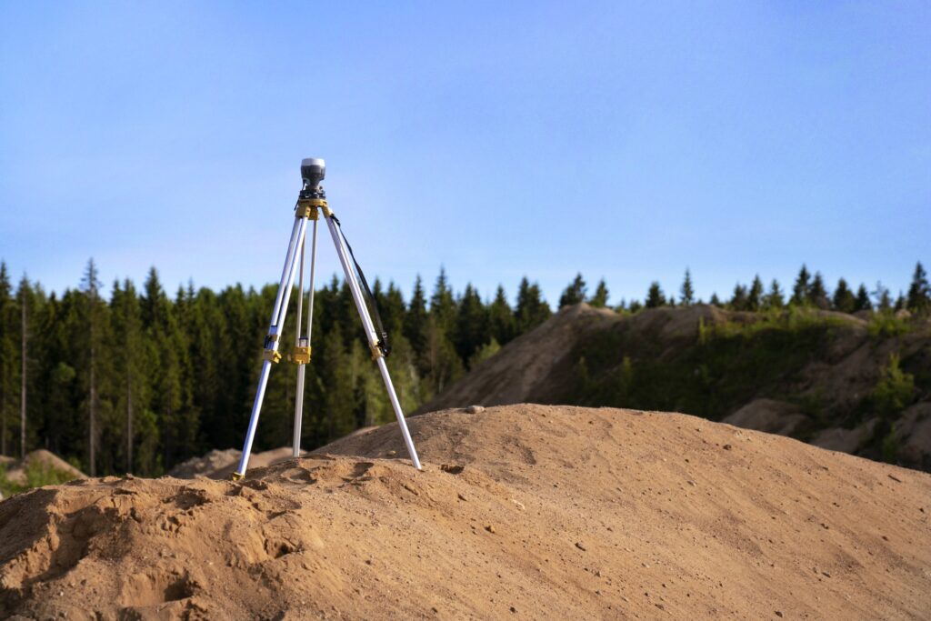
Land surveyors must take images and make calculations in order to verify boundary lines. They must also work with high-end field equipment, which can include everything from aerial scanners to GPS systems. While land surveyors oftentimes work directly for developers, these professionals can also survey for tunnel building, major construction, and mining interests.
In the event that you become a land surveyor, you will be responsible for remaining up-to-date with the latest changes in property law. Along with measuring land, land surveyors must be expert consultants to architects, engineers, and developers. Each state has different requirements that you must meet if you want to become a land surveyor. These requirements can differ in certain situations. For instance, it’s possible to work as a land surveyor without a license. If you want to earn a California Professional Land Surveyor License, you will need to first obtain six years of work experience as a land surveyor.
To qualify for any type of job as a land surveyor, it’s recommended that you first obtain a bachelor’s degree in related fields, which can include geography, cartography, surveying, computer science, and engineering. While you can work as a land surveyor without a license, the only way to certify legal documents is by first obtaining a license. The California license can only be obtained if you have the requisite experienced mentioned previously and have passed four separate examinations. The average salary for a land surveyor is just over $65,000.
Land surveyors are needed for a wide range of projects. Any location where someone wants to mine, settle, farm, or build must be surveyed to make sure that the boundaries are properly drawn. It’s essential that properties don’t overlap with one another, which would lead to disputes. When someone purchases land that they would like to develop, the land must be surveyed before the property owner can go through the building permit application process, which itself could require expediting. This article takes you through a day in the life of a land surveyor.
Tasks of a Land Surveyor

Land surveyors have a wide range of tasks that they will be required to complete during any given project. The primary tasks that nearly all land surveyors perform include:
- Measuring angles and distances between points that are below, on, or above the earth’s surface
- Researching survey records, land records, and titles
- Traveling to different locations to identify the specific location of important features
- Preparing various maps, reports, and plots
- Looking for any signs of previous boundaries to ascertain where the boundary lines are situated
- Recording survey results to verify data accuracy
- Presenting findings to government agencies and clients
- Officially establishing water and land boundaries for leases and deeds
If you enter a career as a land surveyor, you can work in an office or in the field. It’s also possible to work in both settings, which provides some variety to the workweek. During fieldwork, land surveyors must work in all kinds of weather, stand for lengthy periods of time when performing measurements, and walk very long distances. Depending on the layout of the land, you may need to climb hills and uneven terrain with heavy packs of different surveying instruments and equipment. Traveling occurs on a regular basis. Land surveyors typically work for property owners, civil engineers, and project managers during a construction project.
Different Types of Land Surveys
There are seven distinct land surveys that a land surveyor can perform while on the job. These surveys include:
- ALTA survey
- Subdivision survey
- Boundary survey
- Location survey
- Construction survey
- Topographic survey
- Site-planning survey
An ALTA survey occurs when purchasing an investment property or home. Before a title company issues title insurance, they usually request ALTA surveys. Lenders may also require ALTA surveys before they will provide financing.
Subdivision surveys are designed to separate a piece of land into numerous lots to create a subdivision. This survey must be placed into land records, which can be done at the recorder’s office.
Boundary surveys identify property boundaries as well as the corners on a specific piece of land. If two property owners have a legal dispute, a boundary survey can be performed to settle the dispute.
Location surveys are very similar to boundary surveys with the primary difference being that site improvement are included on the survey. This type of survey may be necessary for zoning permits.
Construction surveys occur when a surveyor stakes out a location where improvements are set to occur and structures are scheduled to be built. Once the survey has been performed, construction teams can use the results to know where to build.
Topographic surveys show the locations of man-made and natural features on different properties. These features can extend to elevations, buildings, trees, fences, ponds, and utilities. This type of survey is commonly used by architects and engineers when planning extensive site improvements.
The final type of survey is a site-planning survey, which is necessary to plan the development process for site improvements. The improvement or structure that’s set to be built will be drawn within the boundary survey. This specific survey is mainly used when applying for a building permit. The survey must be provided to the LADBS along with all of the other documentation that’s required when applying for a permit.
Skills Needed to Be a Land Surveyor
If you want to become a land surveyor, it’s important that you have the right skills for the job, most of which you should learn while seeking your bachelor’s degree or during your on-the-job experience. For instance, communication skills are a necessity. You will need to be able to provide clear instructions and reports to government officials, team members, and clients.
You must also follow instructions set forth by construction managers and architects. While a job is progressing, you will oftentimes be tasked with explaining the amount of progress that has been made to government authorities, lawyers, financiers, and developers. Precision is also a must when performing your everyday tasks. The documents you produce are legally binding, which means that any mistakes you make can create significant problems.
As mentioned previously, you’ll likely need to walk long distances, stand for lengthy periods of time, and climb hills on occasion, which means that you should have enough physical stamina to withstand the tasks that are asked of you. You’ll likely want to have strong time-management skills as well. You will need to plan your schedule and the schedules of your team members while on the job. Time-management skills come in handy when you’re attempting to meet strict project deadlines. Make sure that you also have some visualization skills. You should be able to properly envision altered terrain and new buildings while performing surveys.
When Might You Need a Land Survey Completed?
There are many reasons why a land survey would be necessary. Looking at a simple legal description of a property might not be enough to ascertain where the boundary lines are located. Hiring a land surveyor allows you to meet various requirements that may be called for when improving property or purchasing one. The primary reasons why land surveys are sought include:
- Obtaining title insurance
- Finding current property lines
- Meeting mortgage loan requirements that were set by a lender
- Settling disputes over boundary lines
- Obtaining title insurance
- Locating any easements on the property
- Having a better idea of what you’re buying
- Purchasing a home or similar structure
- Locating existing utilities on the property
- Updating property surveys that contain outdated information
It’s common for older real estate descriptions to include references to monuments or landmarks that haven’t been on the property for years. In order to make sure that the boundary lines are accurate, a new land survey may be necessary. New survey monuments can be placed on the survey to be used as reference points for boundaries and corners.
Land surveyors are essential to the successful completion of nearly all construction projects. In fact, you may be unable to obtain a building permit until you provide the LADBS with a new land survey. If you’re hiring a land surveyor for an important project, make sure that you do your research and hire someone who has the experience and reputation needed to complete any land surveying job.

Jason Somers, President & Founder of Crest Real Estate
With over 15 years of professional experience in the Los Angeles luxury real estate market, Jason Somers has the background, judgement and track record to provide an unparalleled level of real estate services. His widespread knowledge helps clients identify and acquire income producing properties and value-ad development opportunities.
Learn more about Jason Somers or contact us.