What is Land Surveying: Legal Descriptions and Tangible Boundaries
Land surveying is the foundation for construction and property ownership, offering a meticulous understanding of our terrain. While many envision land surveying as a modern necessity, its roots delve deep into the annals of history, echoing the precision of prehistoric surveyors at sites like Stonehenge and the practical applications in ancient Egypt. In this article, we embark on a journey to unravel the essence of land surveying — from its historical origins to its contemporary significance. By the end, you’ll gain insight into the art and science that shapes our understanding of property boundaries and secures our landowner rights.
A Brief History of Land Surveying
The roots of land surveying stretch back to ancient times, with intriguing evidence suggesting that prehistoric surveyors meticulously laid out the iconic monument of Stonehenge around 2500 BC. Using primitive yet effective tools like peg and rope geometry, these early surveyors showcased an early understanding of spatial relationships, laying the groundwork for future land surveying techniques.
In ancient Egypt’s cradle of civilization, land surveying took on a practical role amid the yearly inundation of the Nile River. As the river’s overflow washed away farm boundaries, surveyors, known as rope stretchers, applied simple geometry to re-establish these boundaries. The remarkable squareness and north-south orientation of the Great Pyramid of Giza, constructed around 2700 BC, stand as a testament to the Egyptians’ mastery of surveying, showcasing their ability to create structures aligned with precision.
This historical exploration highlights the enduring significance of land surveying, a discipline that has evolved over millennia, shaping the way we perceive and delineate the lands we inhabit.
What is Land Surveying?
Land surveying, both an art and a science, serves as the cornerstone for establishing and re-establishing the essential elements of real property. It involves determining and documenting corners, lines, boundaries, and monuments through a meticulous process guided by recorded documents, historical evidence, and contemporary standards of practice.
Land surveying encompasses a broad spectrum of activities aimed at understanding and defining the geographical characteristics of a given area. This includes the physical aspects of the land and associated services crucial for various purposes.
Core Services in Land Surveying:
- Analysis and Utilization of Survey Data: Surveyors leverage advanced techniques to analyze and utilize survey data, providing valuable insights into the characteristics of the land.
- Subdivision Planning and Design: The expertise of surveyors is often enlisted in the planning and design of subdivisions, ensuring optimal land use and adherence to regulations.
- Legal Descriptions: Crafting accurate and legally binding descriptions of the surveyed land is fundamental to the surveyor’s role.
- Mapping: Surveyors create detailed maps that encapsulate the spatial features of the land, offering a comprehensive visual representation.
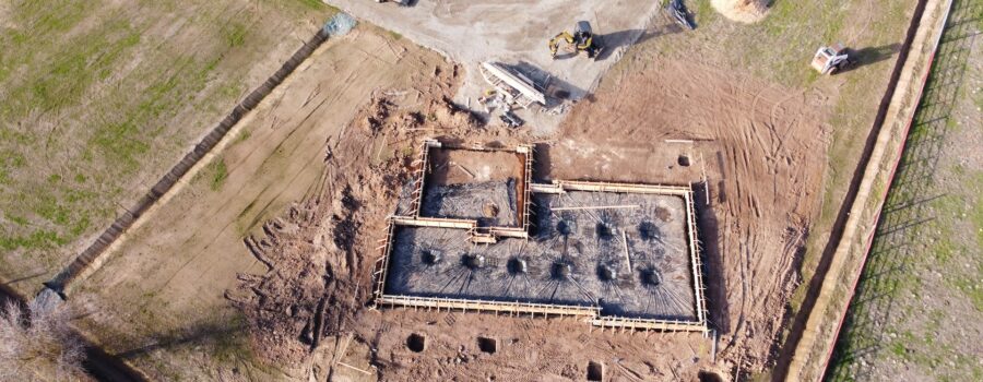
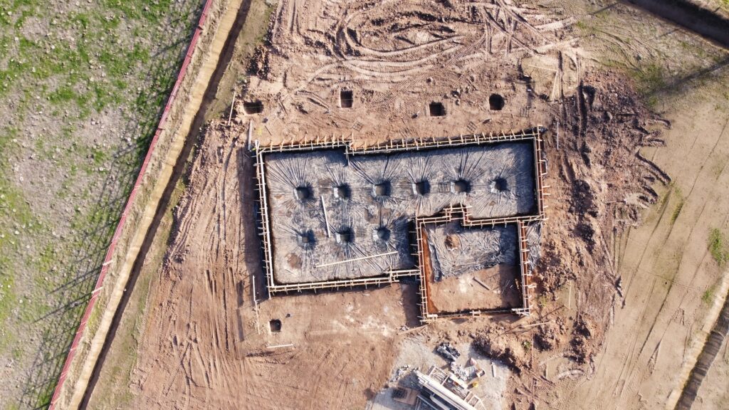
- Construction Layout: In construction projects, surveyors play a vital role in laying out precise measurements for the placement of structures and infrastructure.
- Precision Measurements: Land surveyors employ specialized tools to measure angles, length, area, and volume with a high degree of accuracy.
At its core, the primary responsibility of a land surveyor is to locate and define the boundaries of a property. This involves translating legal descriptions into tangible markers on the physical land, providing property owners a clear understanding of their ownership rights.
Land surveying, a fusion of archeological precision and private investigative skills, offers independent and reliable information that safeguards property rights. The following sections will delve into the intricacies of the surveying process, its historical significance, and contemporary applications.

Land Surveying Overview
Navigating the intricacies of land ownership and property delineation requires the expertise of land surveyors. In this Land Surveying Overview, we delve into the fundamental aspects of their work, focusing on the paramount tasks that define the profession. From finding property boundaries, interpreting legal descriptions, and marking boundaries on the land, land surveyors serve as guardians of precise boundaries. This overview sheds light on the crucial role they play in transforming legal descriptions into tangible realities, ensuring property owners have a clear and accurate understanding of their land’s extent:
- Finding Property Boundaries: Land surveyors play a crucial role in locating and defining the boundaries of a property. This involves interpreting legal descriptions and physically marking the limits on the land.
- The following are legal descriptions: Legal documents that describe the property boundaries that guide a land surveyor’s work. Surveyors meticulously follow these descriptions to ensure accurate placement of boundary markers.
- Marking Boundaries on the Physical Land: Surveyors physically mark the land’s boundaries using specialized tools and techniques. This tangible demarcation provides property owners with a clear understanding of the extent of their land.
Importance of Land Surveying
Land surveying is critical in property ownership, construction, and development projects. By providing accurate and comprehensive information about the land, surveyors enable property owners to make informed decisions and developers to plan and execute projects precisely.
Fusion of Archeology and Private Investigation
Land surveying is a unique blend of archeological precision and private investigative skills. Surveyors delve into historical records, interpret legal descriptions, and apply advanced measurement techniques to unearth the intricate details of a property’s boundaries. This combination of skills ensures that the information provided is accurate and stands up to legal scrutiny.
In the subsequent sections, we will explore the surveying process, from the initial measurements and research to the creation of detailed maps. Understanding the multifaceted nature of land surveying enhances our appreciation for its role in shaping our built environment and safeguarding property rights.
Land Surveying as Archeology and Private Investigation
Land surveying is a discipline that marries the precision of archeology with the investigative prowess of a private detective. It involves meticulously exploring historical records, legal descriptions, and physical landscapes to uncover the hidden details of a property.
Providing Independent Information
- Historical Exploration: Surveyors act as modern-day archeologists, delving into historical records and artifacts to understand the evolution of property boundaries over time. This historical context adds depth to their surveying work.
- Interpretation of Legal Descriptions: Surveyors interpret legal descriptions with a keen eye for detail, ensuring the established boundaries align precisely with the documented information. This interpretation requires a nuanced understanding of legal language and property documentation.
- Advanced Measurement Techniques: Using cutting-edge technology, surveyors employ advanced measurement techniques to accurately determine the land’s angles, lengths, and contours. This scientific precision is crucial for providing reliable and independent information.
Safeguarding Property Rights
- Legal Scrutiny: Like private investigators, land surveyors meticulously gather evidence and present it in a format that can withstand legal scrutiny. This is particularly crucial in cases of property disputes or when providing expert testimony in court.
- Boundary Marking: Surveyors offer tangible evidence that reinforces the legal descriptions by physically marking property boundaries. This visible distinction protects property rights and serves as a practical guide for landowners.
The dual role of land surveyors as archeologists and private investigators underscores the importance of their work in maintaining the integrity of property boundaries. As we navigate the intricacies of land surveying, from historical roots to contemporary applications, it becomes evident that surveyors are not merely technicians but guardians of property rights, ensuring that the past and present merge into a precise understanding of the lands we inhabit.
Conclusion
In the intricate tapestry of land surveying, we have unraveled the threads that weave history, precision, and legality into a comprehensive understanding of our surroundings. From the prehistoric origins hinted at by Stonehenge to the practical applications in ancient Egypt, land surveying has evolved into an art and science that shapes our landscapes.
Land surveyors, with their dual roles as archeologists and private investigators, stand as guardians of property rights. Their meticulous work, interpreting legal descriptions, conducting historical explorations, and employing advanced measurement techniques ensures that property boundaries are not just lines on paper but tangible, defendable boundaries on the land.
As we appreciate the multifaceted nature of land surveying — from finding property boundaries to providing expert testimony in court — it becomes clear that surveyors play a pivotal role in the timely and quality execution of construction and development projects. Their ability to blend the precision of science with the depth of historical insight makes them indispensable contributors to our built environment.
So, whether you’re a property owner seeking clarity on your land boundaries or a developer embarking on a new project, understanding the significance of land surveying is critical. Through surveyors’ expertise, we navigate the complexities of legal descriptions, historical records, and the physical terrain, ensuring that our properties are not just spaces but well-defined and protected pieces of the earth we call our own.

Jason Somers, President & Founder of Crest Real Estate
With over 15 years of professional experience in the Los Angeles luxury real estate market, Jason Somers has the background, judgement and track record to provide an unparalleled level of real estate services. His widespread knowledge helps clients identify and acquire income producing properties and value-ad development opportunities.
Learn more about Jason Somers or contact us.